

Orlando weather: Sweltering stretch continues; Storm Team Alert Day on Tuesday
Orlando PM Weather Forecast: Central Florida continues to bake in the heat
Another Storm Team Alert has been issued for our Tuesday thanks to the oppressive heat. Meteorologist T.J. Springer tells us how hot it'll feel tomorrow and if any relief is in sight.
ORLANDO, Fla. - A dominant ridge of high pressure remains in control across Central Florida as the workweek begins, keeping dangerously hot conditions in place.
Anyone spending time outdoors should avoid overexertion and take frequent breaks.
Rain chances increase
What To Expect:
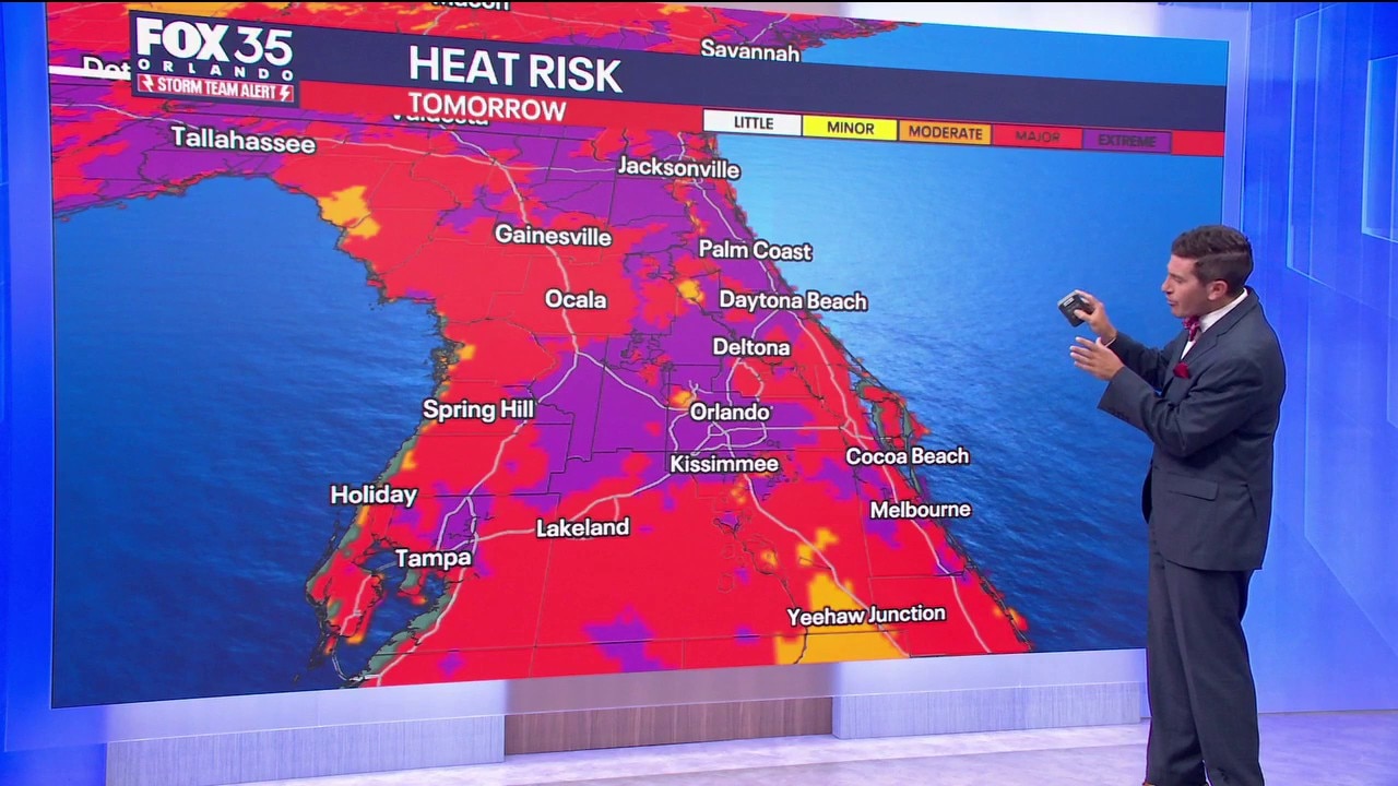
Tuesday will bring another round of intense heat, prompting a continued Storm Team Alert. A major-to-extreme heat risk is expected across Central Florida, with heat index values reaching the upper 100s to lower 110s. A few locations could feel even hotter.
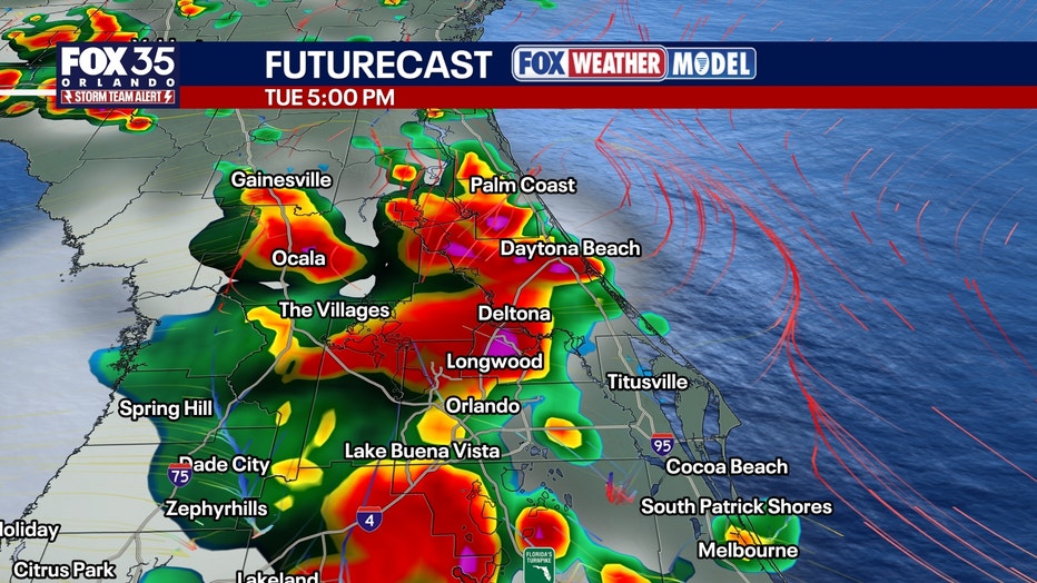
Additional heat advisories are likely Tuesday and could remain in effect into the evening. Temperatures should gradually ease later in the week as a dip in the jet stream approaches the region.
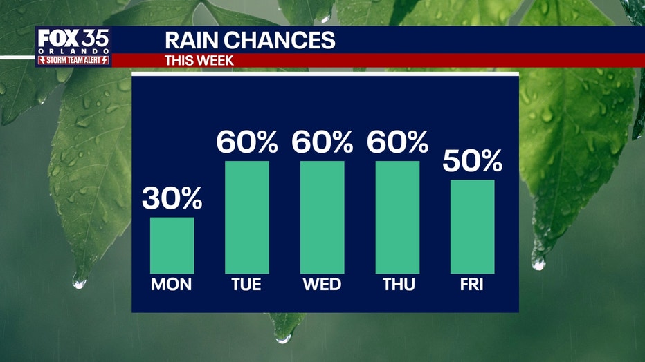
Rain and storm chances are climbing following a relatively dry stretch over the past week. The ridge of high pressure will begin to weaken as a front approaches from the north.
The boundary is expected to stall across the region around midweek, bringing more widespread showers and thunderstorms Tuesday. Rain chances will increase to around 60%.
A few storms could become strong or severe, with damaging wind gusts the primary threat. Frequent lightning and torrential rainfall will also be possible.
Scattered showers and thunderstorms will remain in the forecast through the second half of the workweek as Central Florida returns to a more typical rainy-season pattern.
Tracking the tropics
FOX 35 is monitoring potential tropical activity, but nothing is expected in the next seven days.
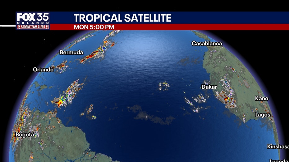
Meteorologists were previously watching two tropical waves. However, these disturbances were sheared away by strong winds aloft or dissolved from the dry Saharan dust.
This trend seems to hold for a while — but the dust will slowly fade away.
The peak of hurricane season is September 10.
The Source: Information in this story was gathered from FOX 35's T.J. Springer.