

Orlando weather: Rain chances increase through Monday ahead of cold front
Orlando AM Weather Forecast: Next cold front brings threat for stronger storms
Our weather pattern is turning unsettled for the weekend. It won't be a washout but Meteorologist T.J. Springer says shower and storms chances are on the rise. A cold front swings through Monday and brings numerous storms and a big cool-down. Here's the latest!
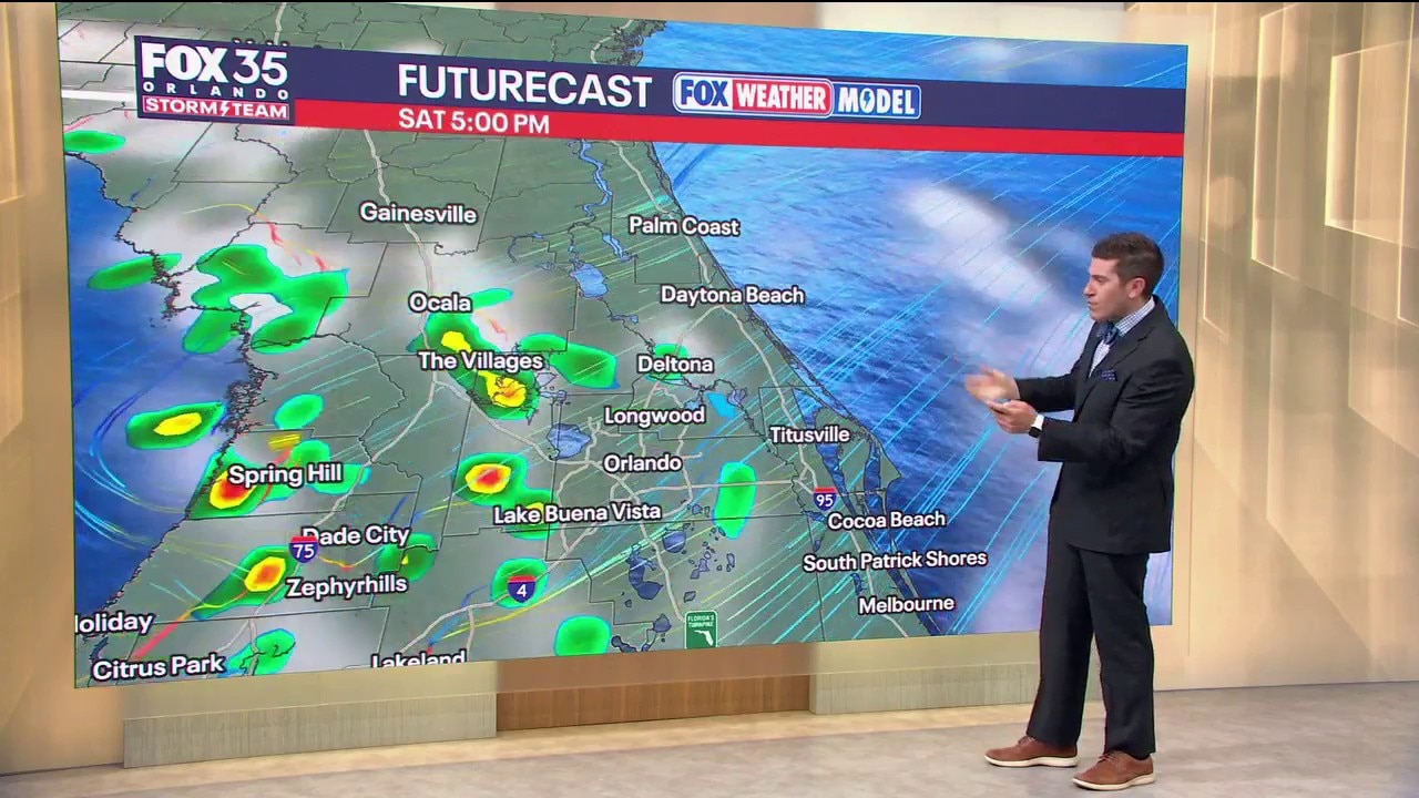
ORLANDO, Fla. - As the onshore flow continues Saturday, more moisture will be transported into the atmosphere.
That'll help keep the chance of a few showers and storms in the forecast. It won't be a washout with rain chances around 40%. That flow, as well as this weak boundary drifting north across the state, will aid in igniting storms.
Highs look to warm back up into the lower 80s under a mix of clouds and sun. It'll be muggier overnight Saturday with warmer lows, in the middle 60s.
What will the weather look like tomorrow?
What to Expect:
As this warm front continues to work northward on Sunday, we'll have more warmth and moisture in the air to aid in igniting storms. We'll have the front aiding in this as well as the sea-breeze collision and some "upstairs energy" in the atmosphere. A couple of these storms could turn severe and there is a MARGINAL RISK of severe weather.
This means any storm that does become stronger could include some gusty winds and possibly small hail.
Temps will stay above normal, topping out in the low to mid-80s. Sunday night will be a little drier, but we could see a few showers and storms lingering with lows in the mid-60s.
Looking ahead
What to Expect:
Another cold front then slides our way Monday, bringing widespread showers and storms.
These could turn severe as this front swings through with a MARGINAL to SLIGHT RISK draped across the region. With more instability and wind energy in the atmosphere, all forms of severe weather are possible, including a spin-up tornado, but those chances are really low.
The main hazards are gusty wind and small hail. High pressure at the surface then builds in on Tuesday, which will help usher in much cooler conditions. We'll still have some spin in the atmosphere aloft which should keep some clouds around too, but it'll be much drier.
If you're getting out and about, highs for St. Patrick's drop back into the upper 50s and lower 60s. That'll be around 15° colder than average for this time of year. Temperatures stay cooler than average into the middle part of next week with highs Wednesday near 70°.
There are some signals that an area of low pressure spins up and tries to bring a little more rain on Wednesday, but chances are slim, around 20%. That slim chance of showers holds into Thursday as temps start to climb back closer to average, rising into the lower to middle 70s.
The Source: This story was written by FOX 35 storm team meteorologist T.J. Springer on March 14, 2026.