Orlando Weather: Pleasant weekend temperatures on the way with high rip current risks
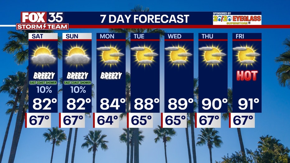
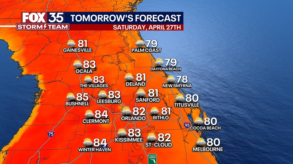
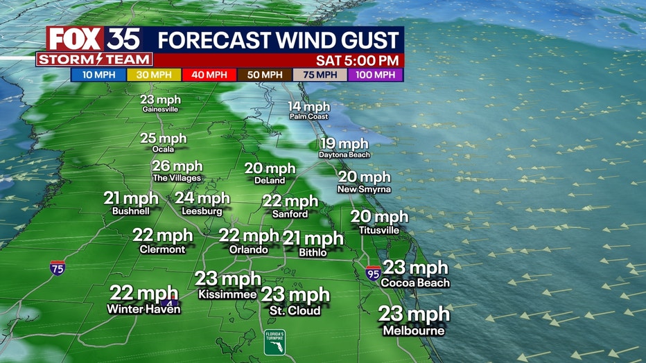
The weekend forecast calls for a mix of clouds and sunshine, accompanied by afternoon highs in the lower 80s. Expect breezy conditions, with east winds ranging from 5 to 15 miles per hour and occasional gusts up to 25 mph.
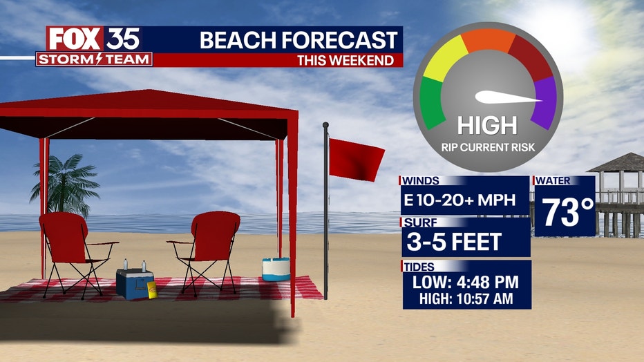
Along the east coast, rough beach and boating conditions are anticipated, with a high risk of rip currents prompting most lifeguard stands to likely post red flags. There's a slight chance (10%) of a rain shower or sprinkle moving inland from the Atlantic Ocean.
LOOKING AHEAD: For Monday of next week, temperatures will be on par with our normal high at this time of year, topping out in the mid-80s. The day will remain gusty but with brighter skies.
Looking ahead towards the mid to late part of next week, we're still seeing signals of a big warm-up with highs in the 90s, possibly. So far, the 90s look to arrive by Tuesday and Wednesday of next week. With high pressure dominating the forecast, we look to stay rain-free. The dry spell is expected to persist for the foreseeable future.