

Orlando weather: Temps to top out in the 90s across Central Florida this weekend
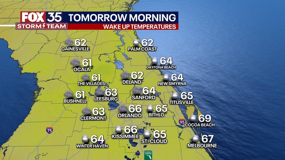
ORLANDO, Fla. - TONIGHT: It will be a mild night under mostly clear skies. Some patchy dense fog may form in the early hours of Saturday for western counties (Lake, Sumter, Marion). Lows will fall into the low to mid-60s.
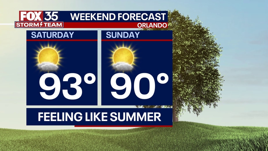
THIS WEEKEND: Temperatures continue to climb this weekend. Saturday will be the warmer of the two days, with highs well above average and approaching record levels. See below for some close calls! Plan for temperatures to top out in the low and mid-90s across Central Florida throughout the weekend under a mostly sunny sky. Wear the sunscreen and be sure to stay hydrated for any outdoor plans.
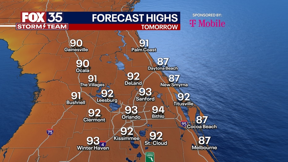
RECORDS FOR APRIL 20:
- ORLANDO - 96 (1908)
- SANFORD - 95 (2006)
- LEESBURG 93 (2006)
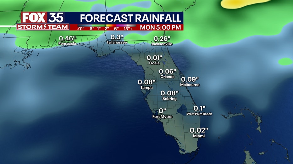
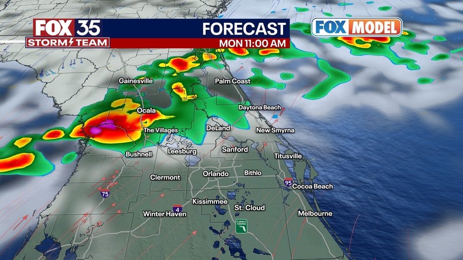
LOOKING AHEAD: Our next chance for rain comes Monday with a weak cold front set to kick off a few scattered showers and/or thunderstorms. It'll knock our temps down to near-normal (but still just above) temps through the middle of next week. The front will be fading as it reaches Central Florida, so severe weather isn't anticipated at this time.
BURN ALERT: We've got several prescribed burns approved by the FL Forest Service, potentially producing large smoke plumes. Winds will be variable under high pressure, so with the exception of the sea breeze to keep the coast clear, it'll be tough to call exactly where the smoke will go. There's potential for some nasty air not really moving too much when these get lit.
THIS